Volumetrics
Volumetric Products:
- Shaded Relief Map
- 3D Map of the Site
- Contours
- Cross Sections
- Orthophotos
- Photo Enlargements
Reports:
- Raw DEM ASCII Files
Volumes based on:
- Toe to toe
- Current to original ground
- Current to previous
- Current to planned
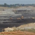
The use of photogrammetric methods to determine the volume and subsequently the tonnage of material such as coal, rock, and sand has been in proven use for many years. G-Squared provides volumes of these and other materials on a year round basis and specialized in responding to your end of quarter/year requirements. Photogrammetric accuracies are within 2% of field-collected values at a fraction of the cost of field surveys, satisfying the need for cost effective, timely, and accurate volumes to validate period audits.
The surface data is collected using our First Order Zeiss P-3 Analytical Stereo Instrument and the new Softcopy workstations. Break lines and mass points are collected at appropriate locations and spacing to assure that the model accurately represents the site.
As a quality check, we generate contours of each site at the stereo instrument to validate the raw data. These contours are compared directly on the instrument for accuracy and inspected for anomalies which may affect the final calculations.

The data is then transferred to a digital workstation where a surface is created and the final calculations are made based on a specific area of interest and mode of calculation. Deliverable data includes certified tabular reports as well as the raw data for our clients’ internal use. Deliverable data is available in a variety of formats to satisfy all clients.